



By Jack Mercer – Rabbit Hole Fisherman
A rafting expedition down Tasmania’s Franklin River means days of white water, rainforest camps and carrying equipment around rapids too dangerous to run. The journey remains possible because Australians fought to keep the river flowing.
In This Story
- A river with a timetable of its own
- What the guide expects
- Weather that changes the day’s work
- Under the trees
- The dam downstream
- The river’s quieter work
- Something to carry out
The paddle is only part of the job.
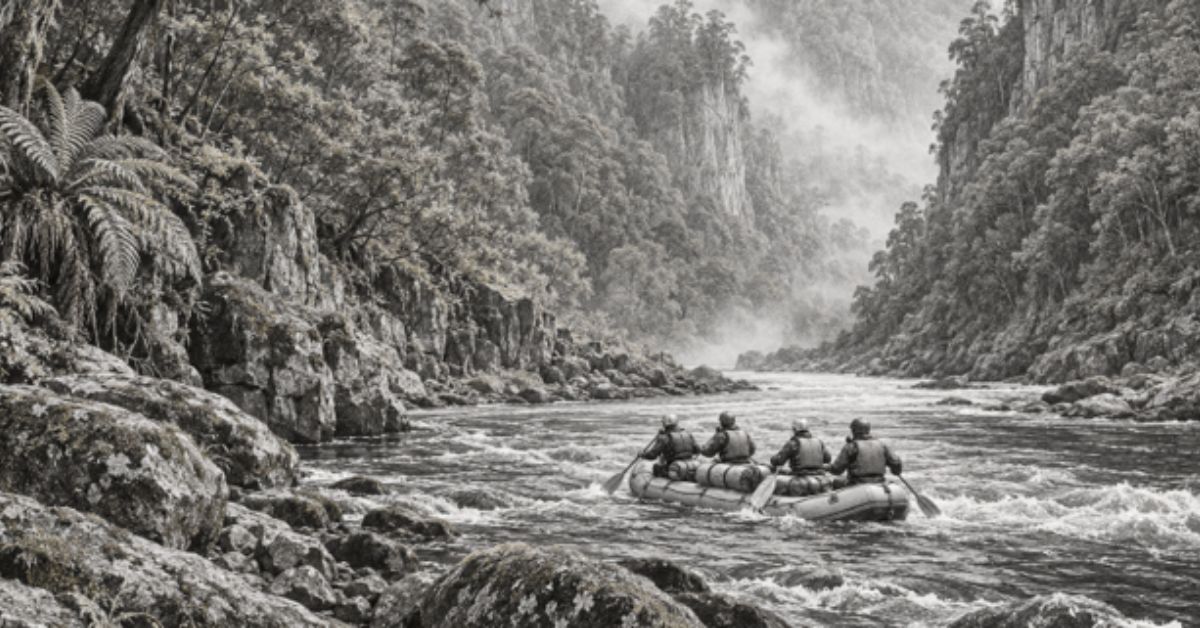
On Tasmania’s Franklin River, there are places where the sensible way downstream involves getting out of the raft. Food and camping equipment must be moved past an obstacle. The boat needs getting through too. A stretch of white water that looks magnificent in a photograph can turn out to be somewhere you spend quite a while carrying things.
That work belongs in the picture. The Franklin offers deep gorges and rainforest, but travelling through it asks for more than an appetite for scenery. Tasmania Parks and Wildlife Service describes it as one of the state’s most remote and committing rivers. Water levels can change quickly, and hazards include log jams that force paddlers to go around them. Experienced paddlers or a qualified, experienced guide are needed.
For people joining a guided trip, the attraction is partly that sustained involvement. You help move the expedition. Decisions about water and weather have consequences for the whole group, whose sleeping bags and dinner travel in the boats with them.
There is a famous history here, of protests and a dam that was never built. Yet the river has a much more immediate way of holding your attention. Before anyone can think about the next campsite, they have to get there.
A river with a timetable of its own
The usual full-river expedition begins on the Collingwood River, reached from the Lyell Highway, and follows it into the Franklin. Downstream lies the Gordon River, where onward transport carries rafters towards the west-coast town of Strahan. The International Rafting Federation describes a typical expedition as taking eight to ten days.
Those days matter. An afternoon’s activity can fit around the rest of a holiday. A week or more on a river begins to organise the holiday around itself. The gear you brought is the gear available. Another layer of clothing has to be in a bag, rather than back in a hotel room.
Water by Nature Tasmania offers full-river trips of seven or eight days, with longer versions incorporating a walk towards Frenchmans Cap. Its full-river description puts the navigable journey at around 110 kilometres and warns that low water and flood conditions can occur within days of each other. Duration and route are expedition arrangements, rather than a promise about what the water will do.
It would be easy to assume that less water means an easier journey. The operator’s seasonal guidance complicates that assumption. Lower levels can mean extra portaging and harder paddling, making a dry period physically demanding. Rain changes the problems again.
A map shows where the river goes. It cannot tell you how much carrying a particular week will require.
The human judgement behind those decisions is part of the adventure. A guide has to assess the passage available today, with this group and this load. An excellent memory of a rapid is useful; it still needs checking against the water actually running through it.
What the guide expects
In a published interview with Tasmanian Expeditions, rafting guide Abigail Nimui gives a practical account of the passenger’s role. She says participants need moderate fitness and should expect to scramble over uneven or slippery ground, help carry equipment and take part in camp work. Previous paddling experience is not required for that company’s guided trip, but contributing to the paddling is.
Nimui also explains that portaging involves getting people, boats and equipment safely below rapids that cannot be run. The arrangements vary with the water level. Her interview is a useful corrective to the idea that booking a guide makes the passenger’s job entirely passive.
It sounds like a fair exchange. You bring enough fitness to help; the guides bring the judgement that gives the effort a purpose. Someone who can tell you when to stop paddling may prove considerably more useful than someone urging you to paddle harder.
The Great Ravine gives that judgement plenty to do. Franklin River Rafting’s published itinerary describes several kilometres containing a concentrated sequence of major obstacles. Progress combines rafting with portaging and lining, the controlled movement of boats using ropes. The Churn is listed as a compulsory portage.
A long day can therefore cover a short distance. You may have worked hard without moving very far down the map, which is an awkward discovery for anyone accustomed to measuring progress by kilometres.
But a gorge is a place to travel through on its own terms. The safe route around one obstacle takes as long as it takes. Rushing to make the numbers look better would be a poor bargain.
Weather that changes the day’s work
The Franklin’s changing levels are more than a qualification tucked beneath an itinerary.
Travel writer Steve Madgwick documented a ten-day expedition in The Wilderness Society’s journal. He reported that the river rose two metres overnight on the third day, prompting a rest day. Persistent rain also prevented his group’s planned ascent of Frenchmans Cap. Those are observations from that particular journey, rather than a forecast for the next one.
They explain why a rest day can be a decision made for you. The expedition has to work with the river that arrived overnight.
The consequences reach into the less glamorous business of camping. Warmth and dry equipment become things to organise carefully. Water by Nature’s equipment list includes full-length wetsuits, personal dry bags, camping shelters, a satellite phone and an emergency beacon. The packing list reads rather differently from one for a riverside picnic.
The dry bag is an ordinary object worth paying attention to. It separates clothes and bedding from the water you are spending days travelling on. Closing it properly is a small task with a large audience later, principally yourself when you need something dry to wear.
A guided expedition makes these details manageable, but it cannot make them irrelevant. There is pleasure in that. The day has a set of practical jobs, and finishing them makes the evening better.
Under the trees
The rafting is only one reason to go. Along the banks is wet temperate rainforest, within a national park that also contains eucalypt forest and buttongrass moorland. The park protects Aboriginal sites recording occupation during the last ice age and remains of deep significance to Tasmanian Aboriginal people. Kutikina Cave is among the places returned to the Aboriginal community under the Aboriginal Lands Act 1995.
So the language of an untouched wilderness needs care. A visitor can be far from a road without being outside human history.
In ABC’s reporting on the Franklin campaign, palawa leader Michael Mansell explains the importance of Kutikina and his concerns about others using Aboriginal heritage to advance their own causes. His account centres ownership and connection to ancestors, even as he agrees that the place needed protection.
That perspective gives the journey a history deeper than the one many Australians first remember. The river’s public fame grew enormously in the early 1980s. Its cultural importance did not begin when it appeared on a protest sticker.
For rafters, evenings take place in riverside camps, sometimes beneath overhangs or on river flats. Water by Nature describes carrying the expedition’s shelter and food in the rafts, with limited comforts and no ordinary mobile reception along the remote journey.
The campsite is where the load becomes useful. Things carried awkwardly past a rapid become dinner, shelter and somewhere to sleep. Even a modest camp represents a satisfying amount of completed work.
There is no need to dress that up as an escape from civilisation. It is a few days spent living with equipment you helped get there, beside a river you are learning to pay attention to.
The dam downstream
The proposal that threatened the Franklin is sometimes described as though somebody planned to put a wall across the river itself. The main scheme was a dam on the Gordon River, downstream of its junction with the Franklin. Its reservoir would have backed up into the Franklin valley. [12]
The location explains the name Gordon-below-Franklin. It also explains why saving one river required stopping construction on another.
The National Museum of Australia dates the proposal to 1978. Cheap electricity and industrial development were arguments for proceeding. Conservationists opposed the flooding, and the dispute spread well beyond Tasmania. A blockade began in December 1982 and continued into March 1983. Bob Brown became one of its best-known figures.
It is tempting to read the outcome backwards, as if the protesters were performing a victory already arranged. They were trying to change a decision with machinery and government backing behind it. Opposition meant organising people, sustaining public interest and taking risks whose outcome remained uncertain.
After winning the March 1983 federal election, Bob Hawke’s government moved to protect the World Heritage area. The dispute reached the High Court. On 1 July 1983, the court’s decision upheld the Commonwealth’s intervention, stopping the project.
For a present-day rafting party, that history has a physical consequence: the gorge is still a gorge through which a river runs. The obstacle ahead still needs inspecting. A place that might have disappeared beneath a reservoir continues to make demands on anyone travelling through it.
There were livelihoods at stake in the dispute too. ABC’s retrospective includes the account of contractor Kevin Bailey, who had invested in machinery expecting work on the dam and faced an uncertain future when it was stopped. Acknowledging those consequences makes the history more honest. It does not lessen what was saved.
The river’s quieter work
Farther downstream, the pace changes. Franklin River Rafting describes wider, quieter water on the Lower Franklin and a transition towards limestone country. Its expedition continues into the Gordon and finishes the rafting at Sir John Falls before boat transport to Strahan.
The paddling still has to be done. A current that has supplied so much drama can also leave a crew with an ordinary stretch of effort. Quiet water is good for looking at the banks, although the raft has a destination as well.
Rock Island Bend carries particular associations with the conservation campaign through Peter Dombrovskis’s photograph. It is also somewhere on the route, reached by travelling through the country around it.
A famous image gives people a place to recognise. An expedition supplies the stretches either side, including the hours that would never make a poster. Those hours are much of the reason for going.
Something to carry out
Keeping the Franklin wild involves present-day behaviour as well as remembering the campaign. Parks and Wildlife identifies the national park as a fuel-stove-only area, prohibits fires and asks visitors to follow Leave No Trace principles.
For the expedition, that is another practical obligation. The equipment brought in has to come out, along with the waste produced during the trip. The memory of an evening under the trees does not need to leave anything behind on the bank.
Anyone considering the journey should check operator requirements against their fitness and camping experience. A guided Franklin trip can accommodate people new to rafting, but the shared physical work remains part of it. Conditions determine the day’s decisions.
Over several days, you learn where your gear is and how to contribute. You also learn when the person reading the water needs everyone to listen.
At the next compulsory portage, the boats and bags still need moving. The sleeping gear you will want tonight is sitting among them.